
About WGL
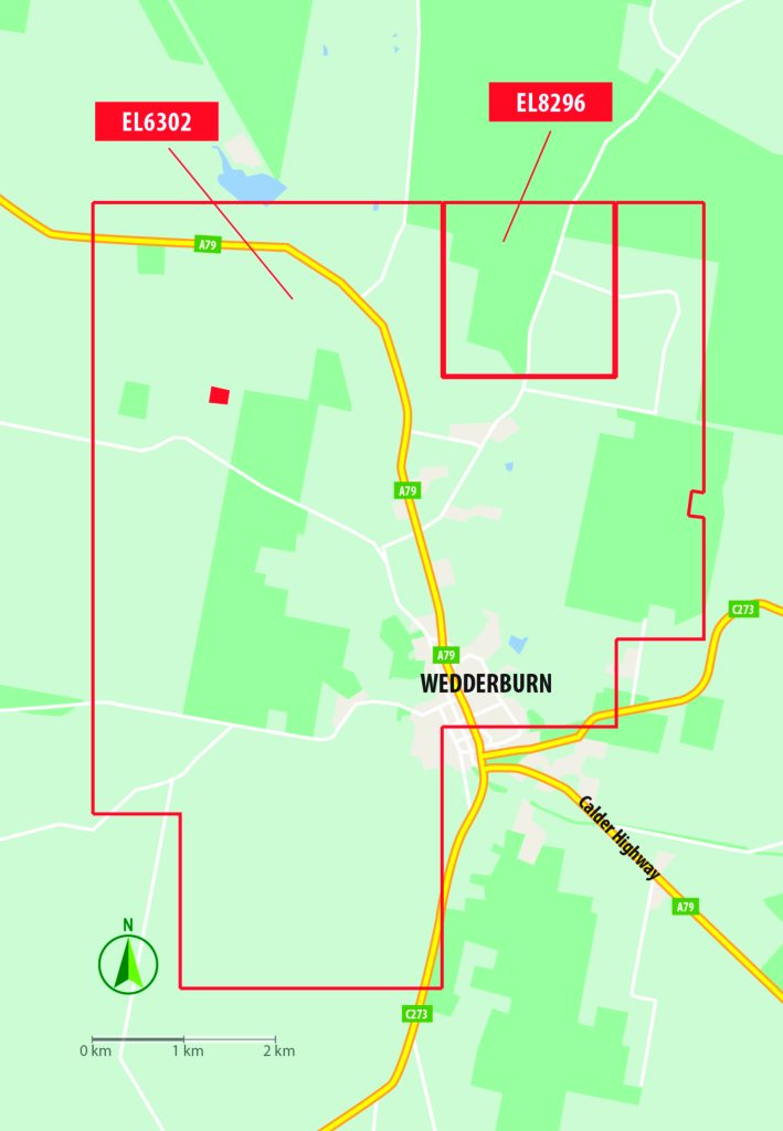
Wedderburn Goldfields Ltd (WGL) is exploring the goldfields of Wedderburn within its 100% owned 51 km² Exploration Licenses (EL) 6302 and 8296 via WGL’s wholly owned subsidiary PSD Minerals Pty Ltd (PSD). The company aims to re-establish underground gold mining in Wedderburn. It plans to extract resources identified using modern geological modelling supported by diamond-drill exploration.
Review of operations
Operating performance
The group’s operating performance during the 2025 financial year centred on defining specific drill-ready targets within the newly interpreted mineralised regional syncline and across the broader exploration tenements, alongside capital raising activities.
Potential discrete high-grade gold dilation zones have been interpreted:
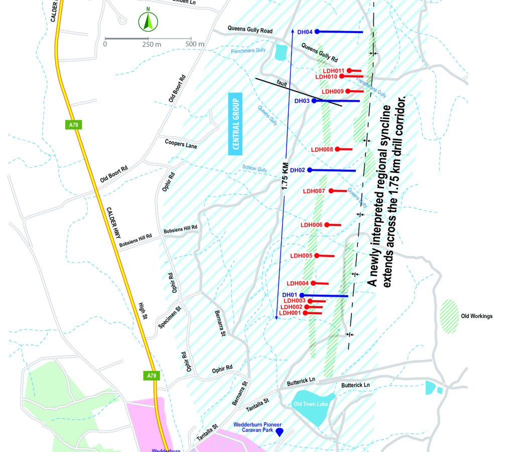
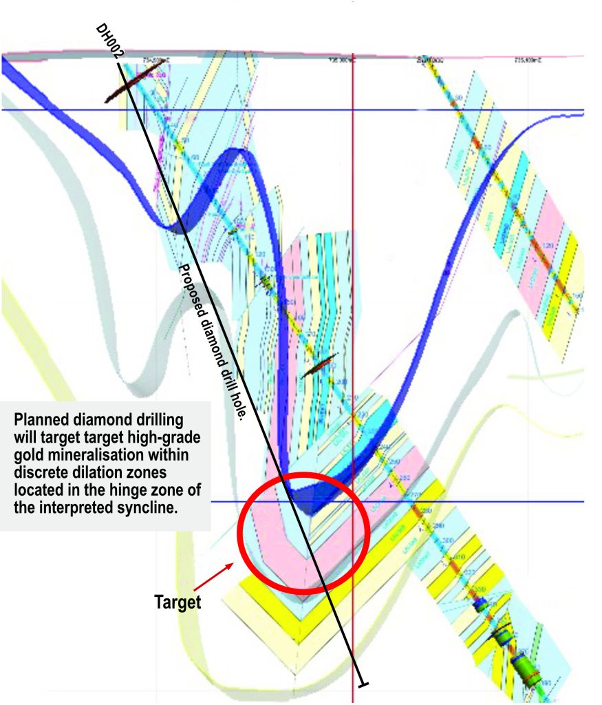
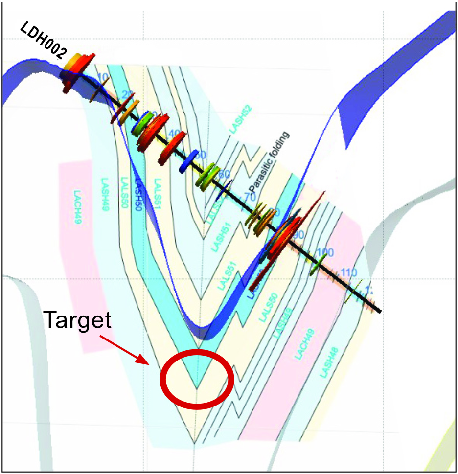
- within the 1.75 km drill corridor, including areas around LDH 001–004, DH 002, parasitic folding near LDH 005, and cross faulting associated with DH 003
- in associated anticlines located to the west and east of the regional syncline
- across 258 geophysically defined areas of interest warranting further exploration.
Operational milestones achieved during the year include:
- implementation of safe work practices, including the use of Safety Manuals across group operations
- contractor operations with no reported lost time injuries
- no known environmental incidents
- full compliance with Federal, Native Title, and Victorian Aboriginal Cultural Heritage and Exploration legislation
- ongoing shareholder and community engagement
- adherence to all applicable agreements, regulations and laws.
Overview of operations for the year
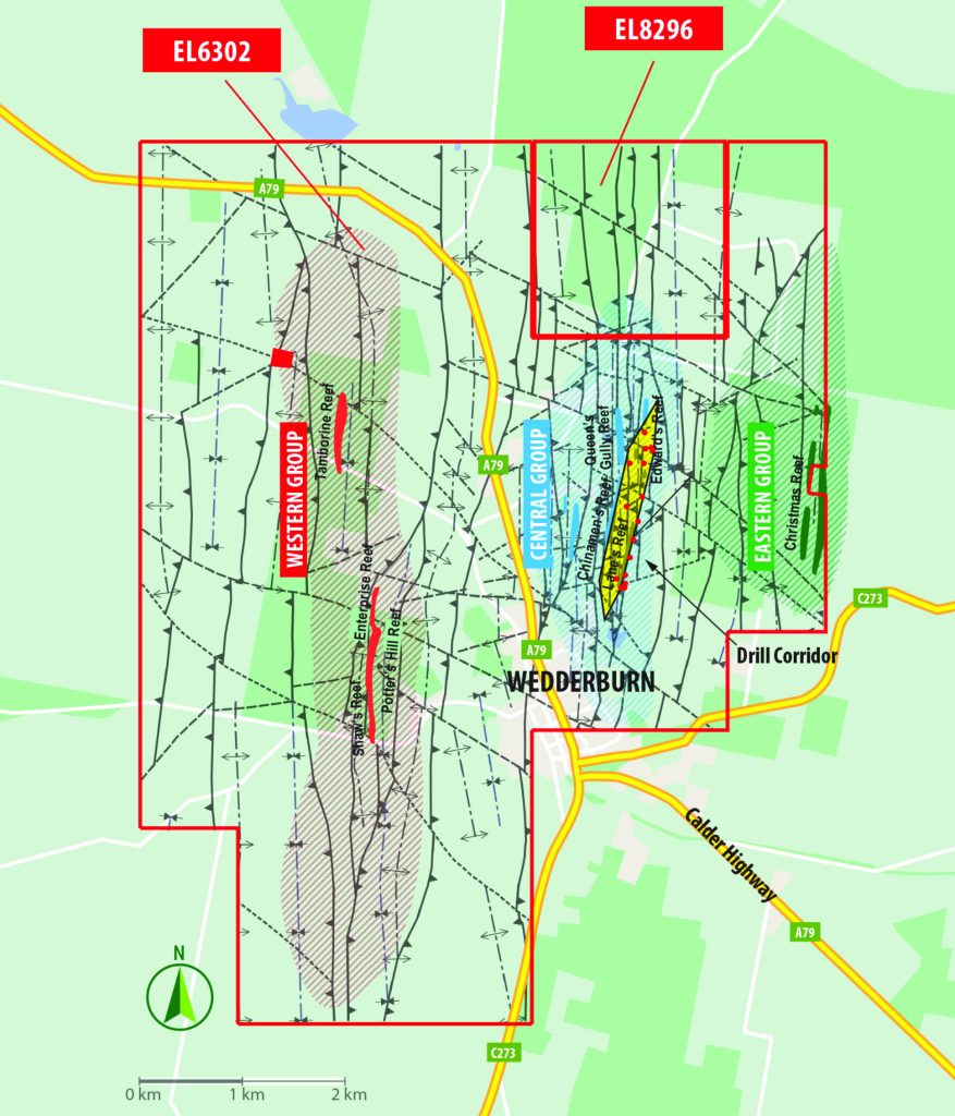
The group’s primary focus during the financial year was the development of drill-ready targets within the 1.75 km drill corridor, targeting two distinct styles of dilation zones located:
- within the newly interpreted regional syncline
- in adjacent west and east anticlines, particularly those influenced by interpreted cross faults
- across the broader tenement package, using advanced geophysical techniques.
Exploration leases
The group holds a 100% interest in Exploration Licences EL 6302 and EL 8296, covering a combined area of 51 km2.
- The exploration area expanded in 2023.
- WGL’s ELs contain the majority of the historic Wedderburn Goldfield.
- Historically, the goldfield produced 150,000 oz of gold, 25,000 oz from underground.
- The Wedderburn Goldfield is a significantly under-explored goldfield with no modern scientific exploration.
Work carried out during this financial year
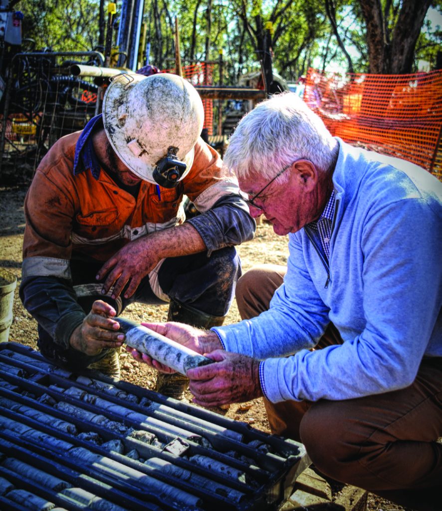
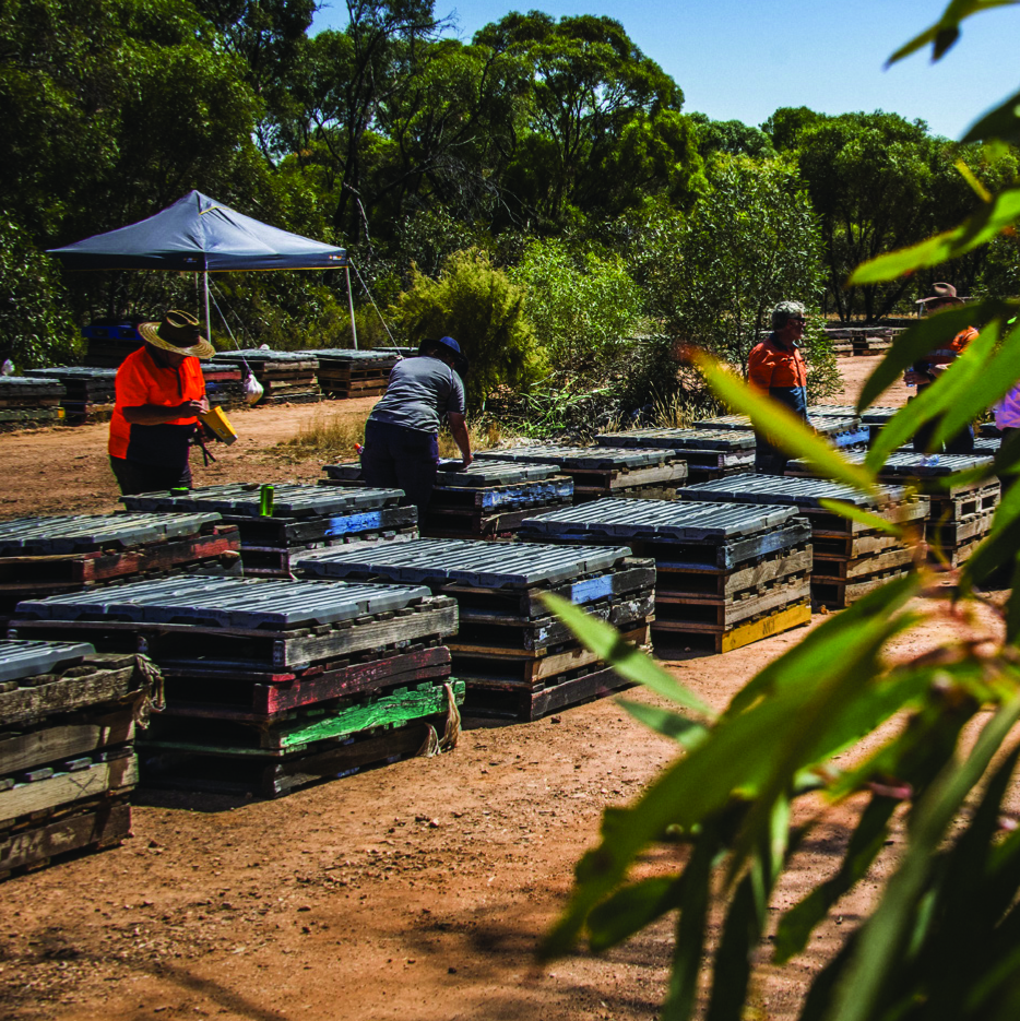
Work for the year has concentrated on establishing drill ready targets for future drilling campaigns within the drill corridor and the overall exploration tenements.
Exploration Update: Bendigo Geological Zone
Key Structures Identified
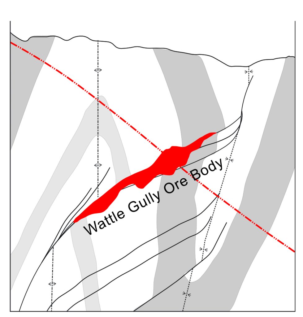
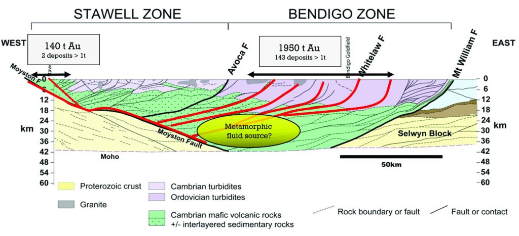
The company continues to advance its exploration activities within its 51 km² exploration tenements within the Bendigo Geological Zone. The Bendigo Geological Zone yielded over 65 million ounces of gold historically and the company has identified key geological structures within its exploration tenements— anticlines, synclines, and reverse faults—known to be associated with significant gold mineralisation across the region.
Historical Production
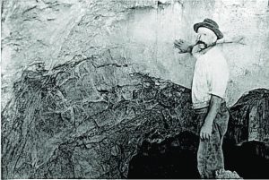
Historical production from the company’s tenements totals approximately 150,000 ounces of gold, comprising 25,000 ounces from shallow shafts within the field’s 33 km of known quartz reefs, and a further 125,000 ounces from alluvial workings.
Goldrush mining operations on the Wedderburn field were brought to a halt when severe droughts during the late 1800s dried up water sources vital for gold extraction, crippling goldfields across northern Victoria and forcing many miners to abandon their claims. This lack of water made it impossible to continue mining activities, dramatically impacting remote mining communities like Wedderburn throughout the region.
“…unless means are at once taken to supply the miners of this district with water for working purposes, many thousands of that class and those connected with it will be subjected to great privation if not reduced to utter destitution.”
Mayor of Sandhurst (Bendigo) John McIntyre, writing to the Minister of Mines for the Colony of Victoria, in 1866.
Successful Proof-of-Concept Program
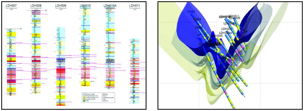
The company’s 3,300-metre proof-of-concept diamond drilling program successfully delineated a newly interpreted regional syncline extending across the full 1.75 km drill corridor. The eastern limb of this syncline is confirmed to be gold-mineralised within a narrow quartz vein, supported by assay data and historical shallow shaft workings.
High-Grade Gold Targets
The company is now positioned to target high-grade gold mineralisation within discrete dilation zones located in the hinge zone of the interpreted syncline. Corresponding anticlines to the east and west of the syncline can now be targeted.
Drilling Campaign
A planned 1,200-metre diamond drilling campaign would focus on the southern extent of the drill corridor, where seven priority targets have now been identified.
These targets include:
- a narrow, mineralised quartz vein hosted within a specific sedimentary unit (“Lash 50”)
- the interpreted hinge zone of the regional syncline, beneath connected leg structures with confirmed gold assays
- zones of parasitic folding
Hinge zones are historically recognised as favourable sites for high-grade gold deposition within dilation zones.
A further 800 metres of drilling would be used for follow-up testing of anticipated successful targets generated from the initial phase. Subject to full funding, the total campaign would comprise of 2,000 metres of diamond drilling.
Gold Mineralisation
Gold mineralisation within the company’s tenements is interpreted to be sourced from deep crustal structures, delivering auriferous fluids into the Wedderburn goldfields via a suitable deep crustal plumbing system. These structures host the discrete dilation zones targeted in the upcoming program.
Validated Geophysical Surveys
Geophysical surveys, validated by surface mapping and drill core analysis, have confirmed the presence of 33 km of auriferous quartz reefs and 178 line-kilometres of fault and hinge zone structures. These have yielded 258 points of geological interest, each representing potential sites for gold-bearing dilation zones.
Effective Modern Exploration Techniques
The identification of a major syncline within the 1.75 km corridor represents a significant departure from historical geological interpretations and highlights the effectiveness of modern exploration techniques. This new understanding is being applied as a predictive tool across both the drill corridor and the broader tenement area.
Corporate information
Shares on issue
Total shares on issue 184,129,809.
Directors:
The names of the directors in office are:
- Richard Sandner (appointed 8 November 2021)
- Wayne John Kernaghan (appointed 9 July 2021)
- John Tasman Andrew (appointed 9 July 2021)
Information on Current Directors:
Richard Sandner, B Juris, LLB – Executive Director
Mr Sandner has long been associated with exploration and mining in north central Victoria, having been a past Managing Director of several ASX-listed companies and Non-Listed Exploration Companies. Mr Sandner was responsible for overseeing several projects that were taken from exploration to production with the gaining of all appropriate permits to allow work to commence and continue. Mr Sandner is currently a Director of Penshurst Resources Limited.
Wayne Kernaghan – Non-Executive Director and Company Secretary
Mr Kemaghan is a member of the Institute of Chartered Accountants in Australia and has over 30 years of experience in various mining industry areas. He is also a Fellow of the Australian Institute of Company Directors and a Chartered Secretary. Mr Kemaghan is also a director and company secretary for several ASX-listed companies.
John Andrew – Non-Executive Director
Mr Andrew has 25 years experience in financial markets, including BT Financial Group, Credit Suisse Private and for the past 18 years advising retail and institutional clients with Bell Potter Securities Ltd.
Principal activities
The principal activities of the Group are exploration for gold and other minerals on Exploration Licences (EL) 6302 and 8296 (which includes the township of Wedderburn), which is some 51 km² in size and situated in central Victoria, in the renowned gold province known geologically as the “Bendigo Zone,” which has historically produced some 65m ozs of gold.