Geological Data Interpretation

The exciting, successful process of interpreting all the geological data gathered to date has determined that many areas within our tenements warrant further exploration.

This process has required patience and a determination to gather much geological data and allow intense interpretation, which has taken time.

Contract geologists have used modern exploration techniques (sophisticated core logging, geophysics, and modern interpretation techniques). All contractors have experience in the Bendigo Geological zone and sophisticated expertise in their respective skill sets.

The exploration tenements at Wedderburn in Victoria  (EL6203 & EL 8296) total 51 km2 and contain a large section of the historic Wedderburn Goldfield.

The 3,308 m, 1.75 km of strike length, 16-hole, proof-of-concept diamond drilling campaign, completed in September of 2022, has been preliminary interpreted. The results indicate that many areas within the exploration tenements warrant further exploration.

As the company gathers further geological information, it anticipates its interpretations of underground geology within the exploration tenements will be enhanced.

Exploration tenements - EL6302 & EL8296 total 51 km2. Clive Willman & Associates geological mapping (bedding, cleavage & younging) of the surface outcrops on the EL has classified various clusters of auriferous reefs into western, central and eastern groups. The central group of auriferous reefs includes Lane’s Corridor, the subject of WGL’s 2022 diamond-drilling program.
Exploration tenements - EL6302 & EL8296 total 51 km2. Clive Willman & Associates geological mapping (bedding, cleavage & younging) of the surface outcrops on the EL has classified various clusters of auriferous reefs into western, central and eastern groups. The central group of auriferous reefs includes Lane’s Corridor, the subject of WGL’s 2022 diamond-drilling program (click to enlarge).

Summary

Wedderburn has the potential for world-class orogenic gold deposits.

Team / Resources

  • Directors have experience in exploration and mining in the Bendigo Zone.
  • All geological contractors have worked within the Bendigo Zone and have sophisticated expertise in their respective skill sets.

Modern-Day Knowledge and Exploration

  • 33 km strike-length of gold-bearing reefs.
  • Geophysics has established fault-fault and fault–hinged zone intersections, which are ground-proofed by drilling.
  • Interpretations of diamond core anticipate the presence of discreet dilation zones:
  • Hinge zone reverse faults produced the most gold in the Bendigo Zone.
  • Vertical Tarnagulla-style gold shoots.
  • The western and eastern corridors of the EL are underexplored.
  • Many areas warrant further exploration.

Project Transformation

  • Ingredients for world-class orogenic gold deposits are present.
  • However, dilation zones are anticipated to be discreet.
  • Exploration has identified many target areas that warrant further exploration.
  • Only a few discreet dilation zones must host orogenic gold deposits for WGL to deliver a significant gold discovery.

Information of Interest

Correct location.

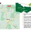
  • The Wedderburn area has good exploration and mining infrastructure, is significantly under-explored, has no modern scientific underground exploration, and is most popular with metal detector operators.

Click to Enlarge.
Click to Enlarge.

Bendigo Geological Zone.

  • The tenements are within this prolific gold-producing structural zone, which has produced 65 million oz of gold.
  • The zone has experienced three distinct gold flow events: 445, 410, and 370 Ma.
  • The style of geological structure (dilation zone) that produced much of the recovered gold is the discreet in size “hinge zones connected by reverse faults”.
  • The exploration tenements have this style of dilation zone within the correct rocks, i.e. Castlemaine Group sediments.
  • Pathfinder minerals for the zone are arsenopyrite, sphalerite, galena, chalcopyrite and pyrrhotite, with carbonate spotting as an indicator that an ore body could be nearby.

Bendigo Geological Zone – home of gold elephants. • Has produced over 65 million oz of gold from important geological structures called dilation zones. • Dilation zones are the result of intense local folding and faulting creating voids that act as pathways for gold mineralisation. • Recently mined examples include Fosterville and Tarnagulla. • Three significant gold mineralising events approx 445, 410, 370 Ma. • Wedderburn’s mineralisation has characteristics similar to those of Bendigo and Fosterville.
(click to enlarge)

Correct geological plumbing system.

  • The 2010 seismic survey by the Geological Survey Victoria (Willman 2010) interprets the essential Castlemaine Group sediments for the Bendigo Geological zone as overlaying Cambrian volcanics. These sediments are interpreted to come closer to the surface of the regional Avoca fault, which is the western boundary of the Bendigo Geological Zone.
  • Notably, the under-explored Wedderburn exploration tenements and the prolific gold-producing Bendigo goldfield (which produced 22 million oz of gold) share a unique feature, as they are both underlaid by separate “splay” faults which may be the source/pathway of gold-bearing fluids being transported to their respective goldfields.

Click to Enlarge.
Click to Enlarge.

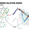
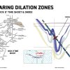
Dilation zones – discreet in size.

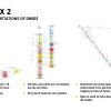
  • One of the aims of the proof-of-concept diamond drilling campaign was to discover which type of “dilation zone” existed within the exploration tenements.
  • Dilation zones are voids within underground geological structures where gold fluids can be deposited.
  • The most prolific gold-producing dilation zone in the Bendigo Geological Zone is the “hinge zones connected by reverse faults” (anticlines and synclines connected by reverse faults). Other styles of dilation zones exist, one being the vertical D3 faults situated in the Bonanza and Nick O’ Time gold shoots at Tarnagulla.
  • Examples of the “hinge zone reverse fault model” include the Swan Zone at Fosterville, which contains 2.7 million oz and is valued at A$8.1 billion, and the vertical dilation zones at Tarnagulla, the Bonanza (360,000 oz, valued at A$1.1 billion), and Nick O’ Time (54,000 oz, valued at A$162million) gold shoots.
    • Both discreet dilation zone styles are anticipated to occur within the exploration tenements.
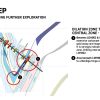
    • Examples include a hinge zone (syncline with reverse fault) below DH002 and a 30 m vertical style zone within a cross fault intercepted at 152 m downhole in DH003.

Click to enlarge.
Click to enlarge.
Click to enlarge.
Click to enlarge.

Exploration methods

Geophysics.

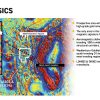
  • The exploration tenements are magnetically unique, as they occur within a 16 km x 5 km area with high magnetic readings, a magnitude higher than anywhere else within the Bendigo Geological Zone.
  • The magnetic areas within the exploration tenements:
      • divide into corridors of high and low magnetic readings,
      • indicate the position of N-S (D1) faults logged in core as hinge zones,
      • the hinge zones are overprinted by NN-W trending cross faults also logged in the core,
      • each lithology (rock type) has its own distinct magnetic susceptibility reading.
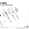
  • The core logging has ground-proofed the N-S (D1) hinge zones, and only two cross faults were deliberately targeted by diamond drilling (holes LDH002 and DH003).

Click to enlarge.
Click to enlarge.

Diamond drilling.

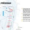
  • Diamond drilling was a “proof of concept” exploration that determined the type of dilation zone in the Els.
  • It was initiated in a drill corridor area with the most scarce historical geological data.
  • Looking to obtain a clearer understanding of the unique geological and geophysical characteristics within the exploration tenements to establish the likely position of discreet dilation zones for future exploration.
  • In two campaigns, the first was a shallow 12-hole program with 1,693 m of drilling, with the second a 4-hole 1,615 m of drilling, over a strike length of 1.75 km, to give accurate underground factual geological information for two distinct depth levels.

Click to enlarge.
Click to enlarge.

Information gathered from the diamond drill core.

Initial core logging & assay.

  • Initial core photography, core preparation for assay, and preliminary core logging was performed in a rented core shed at Inglewood.
  • The highest assay was 3.49 g/t au over 0.2 m from 89 m in LDH002,
  • Other gold assays were above the background level, indicating that the reef structures assayed were auriferous.
  • Differing lithologies (rock types) were noted, with sufficient shale and sandstone present to satisfy the requirement for geological competency for forming hinge zones (anticlines and synclines).

Click to enlarge.
Click to enlarge.

pXRF.

  • The measurements/readings initially mimicked the position of downhole magnetic susceptibility measurements every two metres. Further measurements were sampled from geologically interesting core, (e.g. laminated quartz veins – some gold was measured within these veins).
  • The pXRF machine used in this exploration project takes forty-four individual readings of elements within the core.
  • An example of the measurements/readings is the gold within the boundary of square arsenopyrite crystals within the core (the sulphides hold gold).
  • A study of the laminated quartz veins has been undertaken utilizing the pXRF measurements/readings.

Click to enlarge.
Click to enlarge.

Specialized structural and particle size core logging.

  • The intricacy, detail, and presentation of both logs set a standard.

Click to enlarge.
Click to enlarge.

Interpretation of information gathered from the diamond drill core.

Carbonate spots.

  • These are associated with gold mineralization within the Bendigo geological zone.
  • Holes LDH002, LDH003, and DH 003 all intersected significant zones of carbonate spots, which were interpreted to indicate that an “ore body” may be nearby.

Click to enlarge.
Click to enlarge.

Arsenic geochemistry.

  • In the Bendigo Geological Zone, the presence of significant arsenic readings in a core sample indicates that gold could be nearby.
  • DH003 had the highest arsenic reading of some 7,000 ppm (0.7%) within the 30 m mineralized section from 152 m downhole (the section being interpreted as part of a vertical cross fault).
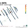
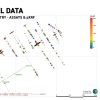
  • Look at the near mirror image of the arsenic and gold readings in the two slides.

Click to enlarge.
Click to enlarge.
Click to enlarge.
Click to enlarge.

Gold Geochemistry.

  • Both assays and pXRF measurements have indicated the presence of gold in some of the laminated quartz veins. This is encouraging; it means some of the reefs containing laminated quartz are auriferous.
  • The deposition of gold in the Bendigo Geological Zone reef systems is sporadic along strike, not disseminated evenly within the reef system.
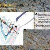
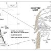
  • The slide is of a mining stope at Tarnagulla, within the Nick O’Time shoot at the RL 990 level. The shoot is some 60 m in strike, some seven metres wide at the centre, narrowing to virtually nothing at all the boundaries, with the grade at the N and S boundaries being less than a gram and vastly varying high-grade composite face samples along strike.
  • The stope was air leg mined from the footwall to the hanging wall of the shoot by cut and fill mining method and recovered 20 g/t au.
  • This sporadic distribution of gold along the strike length of various dilation zones in the Bendigo Geological Zone can be garnered from historical newspaper reports of weekly gold production from multiple mines in the Bendigo goldfield.

Click to enlarge.
Click to enlarge.

Magnetic Susceptibility.

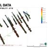
  • These magnetic susceptibility measurements have been used in compiling the 3D model.
  • The highest magnetic susceptibility reading was for pyrrhotite.
  • Within the 3D model, the pyrrhotite can be traced in its interpreted geological structural setting, as can other geological information. The 3D model is a geological interpretative tool.
  • The oxidized zone is bereft of magnetic susceptibility readings (readings were taken but with little result), which indicates that signals from the oxidized zone will not interrupt or interfere with any geophysical search for magnetics.

Click to enlarge.
Click to enlarge.

Laminated quartz reefs (lqrs).

  • All diamond drill holes have several lqrs, some of which have been assayed, and all have been subject to pXRF measurements. Some are known to contain gold.
  • The presence of many lqrs is most encouraging.
  • PGN Geoscience has carried out a study of the lqr data, which found all lqrs had a distinctive but similar makeup, with not enough specific differences noted, to enable tracing of individual lqrs along strike by comparing the individual lqrs makeup. More work is required to establish individual differences in lqrs so that lqrs with a similar makeup can be traced along strike.
  • The presence of lqrs is encouraging. Lqrs makeup/are part of reef structures that pinch and swell in size along strike and down dip. The lqrs are capable of being traced to geological positions e.g. to where the lqrs intersect a dilation zone, thus allowing the lqr to increase in size.

Click to enlarge.
Click to enlarge.

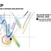
 Areas warranting further exploration.

Geophysics.

  • Identifies 258 fault/fault or fault hinge zone intersections, some crossing known auriferous reefs.
  • The exploration tenements contain a 33 km strike length of mapped gold-bearing reefs.
  • 178 km (strike length) of prospective N-S trending steeply dipping faults and hinge zones, some ground-proofed by core logging.
  • LDH002 core logging interpreted a cross fault at 36 m.
  • Multiple targets along a known mineralized cross fault intersected in DH003 at 152 m downhole, with 30 m of downhole mineralization (core logging interpreted the cross fault).
  • Drilled intersections validate the existence of numerous cross-faults interpreted from the geophysics.
  • The western group of reefs has never been drilled.
  • These geophysical interpretations make the exploration tenements highly prospective for gold.

(CLICK TO ENLARGE IMAGE)

Area between LDH002 and LDH003.

  • This area contains extensive carbonate spots and has high arsenic and magnetic susceptibility readings, including the highest gold assay.
  • A cross fault interpreted at 32 m downhole in LDH002 is situated downdip from a historical mining stope, closer to the surface.

Click to enlarge.
Click to enlarge.

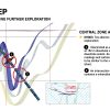
The area beneath DH002.

  • A classic Bendigo Geological zone hinge zone (syncline) reverse fault structure.

Click to enlarge.
Click to enlarge.

Areas associated with DH003.

  • Interpreted 30m downhole mineralized zone (high arsenic and magnetic susceptibility readings with surrounding carbonate spots above background gold assays) vertical cross fault intersects hole at 152 m downhole.
  • A mineralized intersection is interpreted 270 m downhole.

Click to enlarge.
Click to enlarge.

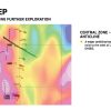
Areas to the west of the drill corridor.

  • The 1.75km strike-length diamond drill corridor is interpreted as a syncline structure situated on the eastern edge of a magnetic corridor.
  • The connecting anticline structure will be to the west of the syncline drill corridor and be situated in a magnetic corridor with a higher magnitude of magnetic reading than the drill corridor.
  • Areas warranting further exploration would be along the mineralized cross fault interpreted in DH003 and opposite holes DH002, LDH002, and LDH003.

Click to enlarge.
Click to enlarge.