Dilation-Zone Structures
The Wedderburn Goldfield sits near the western margin of Victoria’s Bendigo geological structural zone. The Bendigo zone has the greatest gold production, totalling more than 60 million troy ounces, of all Victorian geological zones. It contains most of the state’s 7,000 historical gold mines in major mining centres such as Bendigo, Ballarat, Castlemaine and Clunes. It also hosts the significant modern gold production centre at Fosterville.
EL6302 and EL8296 Feature Dilation Zone Structures
Geologist Clive Willman was engaged to review the history of gold production and exploration at Wedderburn. The brief included structural geological mapping and the compilation of previous prospect mapping of limited outcropping. Willman conducted geological field mapping of the Wedderburn goldfield in 2020, 2021 and 2022.
Each of his survey points was tied to GPS co-ordinates which were cross-referenced with The Wedderburn Goldfield: Volume 10 of Memoirs of The Geological Survey of Victoria (Whitelaw), compiled in 1911 by Victorian Geological Survey geologists O.A.L. Whitelaw and D. J. Mahoney.
Whitelaw gives a credible geological description of the gold deposits of Wedderburn and their geological structures, including anticlines and synclines.
Lane’s Reef
Lanes Reef area in the central group was regarded by Whitelaw (1911) as one of the more important reefs at Wedderburn because of it’s potential to host significant quartz veining in a strike fault that cuts across bedding.
The Baker’s anticline area includes other closely spaced anticlines, such as Gardiner’s and Baker’s. While the Scotch Jock’s anticline and reef is a separate line 100 metres west of the Lane’s – Gardiner’s – Baker’s group of anticlines.
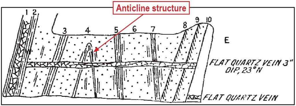
Whitelaw’s cross-section of Baker’s Reef in Baker’s shaft shown at top right depicts the structural geological complexity of Lane’s Corridor, noting the presence of a north-dipping cross reef extending from a laminated quartz reef in the west to a series of faults in the east.
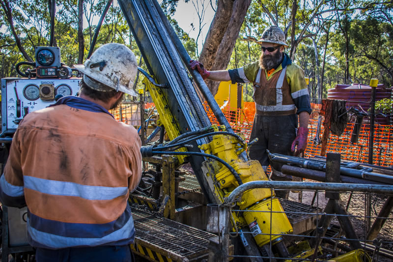
Willman’s review was part of the data used to assist in planning a diamond drilling campaign to evaluate the mineral potential of a portion of the historic Wedderburn Goldfield.


Figure: Cross-section of Baker’s Reef exposed in Baker’s Shaft showing Baker’s flat reef. Baker’s shaft is located just west of Lanes Reef. (1) is a 15cm laminated quartz vein, 2, 3, 5 and 7 are indicator slates, 6 is a ‘Decomposed rock resembling dyke-rock’ , 4 is an anticline hinge and 8, 9 and 10 are faults. Whitelaw (1911).

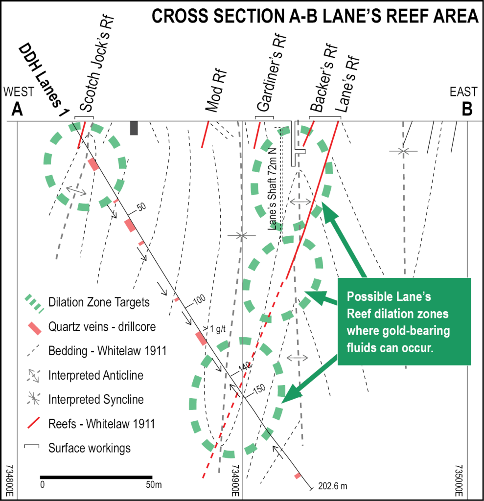
Figure: Cross-section schematic of Lane’s Reef showing dilation zones inferred by interpretation of circa 1980s Carpentaria Exploration Pty Ltd diamond drill core and Whitelaw’s circa 1911 geological investigations.
